UNIVERS — software to process vertical seismic data (VSP, borehole seismic) and interpret them together with log and surface seismic data (2D, 3D).
Preprocessing of 2D surface seismic data using VSP technology methods developed.
Name of the software UNIVERS is formed by beginning letters of the words UNIx VERtical Seismic.
| Certificate |
Patent |
 |
 |
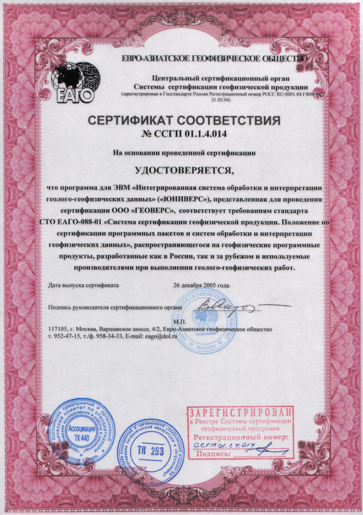
| Certificate of EAGO means matching to requirements of standard “Certification system for geophysical products. Standard to certify software packages and systems for geophysical data processing and interpretation”, which is applied both to russian software products and to foreign ones and used for geological and geophysical investigations. |
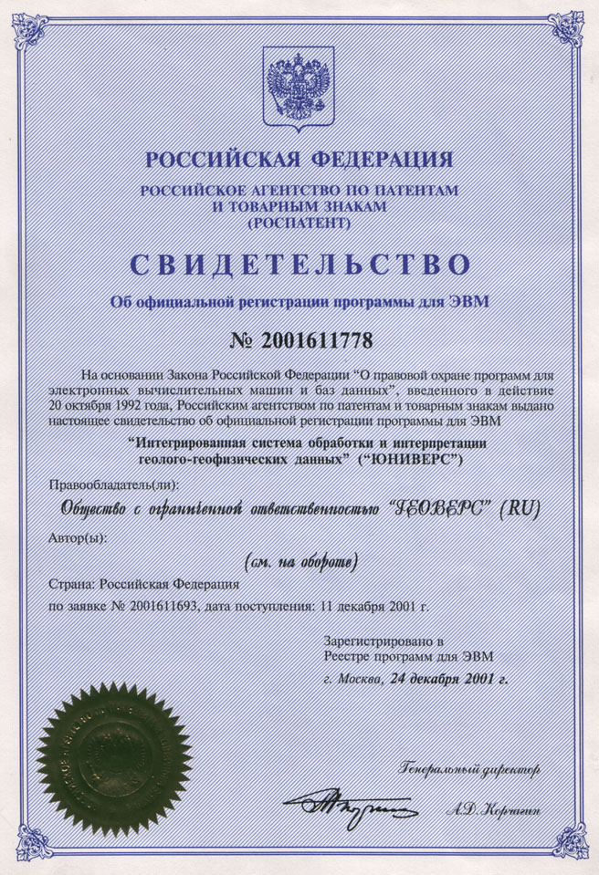
Patent of Russian Federation — the document of Russian agency for patents and trade marks about official registration of computer program "Integrated system for geophysical data processing and interpretation" ("UNIVERS"). |
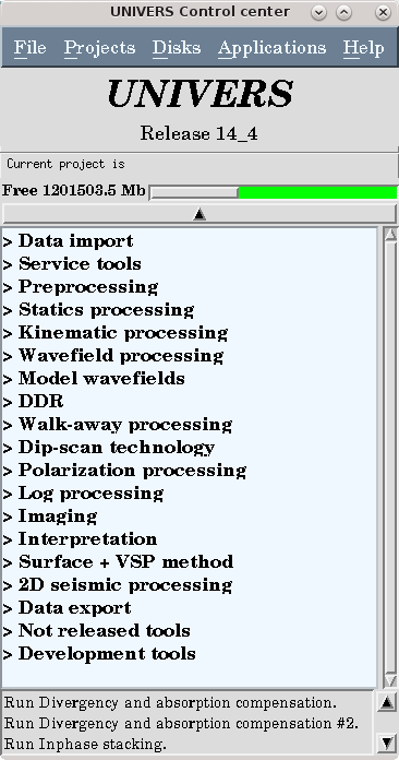
The main advantages given by UNIVERS package. Main processing.(Documentation).
- Сheckshot VSP
- Zero-offset VSP (the nearest SP, zero offset)
- Offset VSP (far SP, far offset)
- Walkaway VSP(walkaway, 2D VSP), 3D VSP
- 2D+VSP, 3D+VSP
- Preprocessing of 2D surface seismic data on the HDS technology
Principles of processing.
- Processing is based on 3D models of subsurface with gradient parameters.
- Wavefield selection is performed iteratively as separation of interferred waves composition. Sum of waves is equal to initial wavefield.
- Specialized methods are used for processing multicomponent (vector) wavefield.
- Seismic data processing is targeted to refining of subsurface medium model as a solution of inverse dynamic problem and imaging of near borehole environment for following interpretation.
- 2.5. Subsurface medium model is refined iterative.
Functional capabilities.
- Detailed lithologic and stratigraphic correlation of surface reflections to well logs
- 1D model estimation in the neighbourhood of the borehole
- Getting of detailed distribution of acoustic impedances in a opened part of the a section and beneath the bottom of the borehole
- Estimation of the absorbing characteristics of media.
- Zero-phase deconvolution of surface reflections from VSP primary reflections
- Getting of detailed images of environment in the near-borehole area by results of data processing of offset VSP
- Designing of VSP acquisition system
- Estimation of 3D environment model with various inclined borders in the neighbourhood of the borehole
- Estimation of rocks fracture and cracks orientation
- Construction geo-stratigraphic model of media and structural maps on the basic of reflectings borders
- Preprocessing of surface data 2D on technology HDS.
Requirements to the environment:
OS Linux 64-bit. The following options are supported:
- OS: RHEL / CentOS / Scientific Linux ver. 5,6 or 7 64-bit
- Data storage is carried out in the file - the focused database.